Before you can create maps based on OpenStreetMap or other tile data, you must set up
a custom map provider and connect Map Manager to a GIS that supports a specific URL
format.
What you should know
Map Manager supports Tile Map Service (TMS) servers, like those provided by the
OpenStreetMap Foundation, that deliver content on URLs with a zoom factor, X position,
and Y position. The format and supported elements are described in the URL format for web tile servers. When using a TMS server, you can
define the boundaries and scale of the tiled map that you need.
To connect Map Manager to a TMS server:
-
From the Config
Tool home page, open the System task, and click the Roles view.
-
Select the Map Manager role, and click the Properties
tab.
-
In the Map providers section, click Add an
item (
 ).
).
-
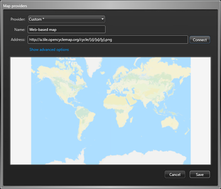
In the Map providers dialog box, select Custom
* from the Provider drop-down list.
-
In the Name field, type a name for the map
provider.
-
In the Address field, type the URL of the TMS
server.
-
If required, click Show advanced options and configure
the following:
- Set the Maximum zoom level supported by the map
to a level between 1 - 25. The default is 17.
- If the server requires authentication, set Use
authentication to ON, and then
enter the username and password.
-
Click Connect.
If you entered a valid URL, the map appears.

-
Click .